Datasets:

metadata
license: mit
task_categories:
  - image-classification
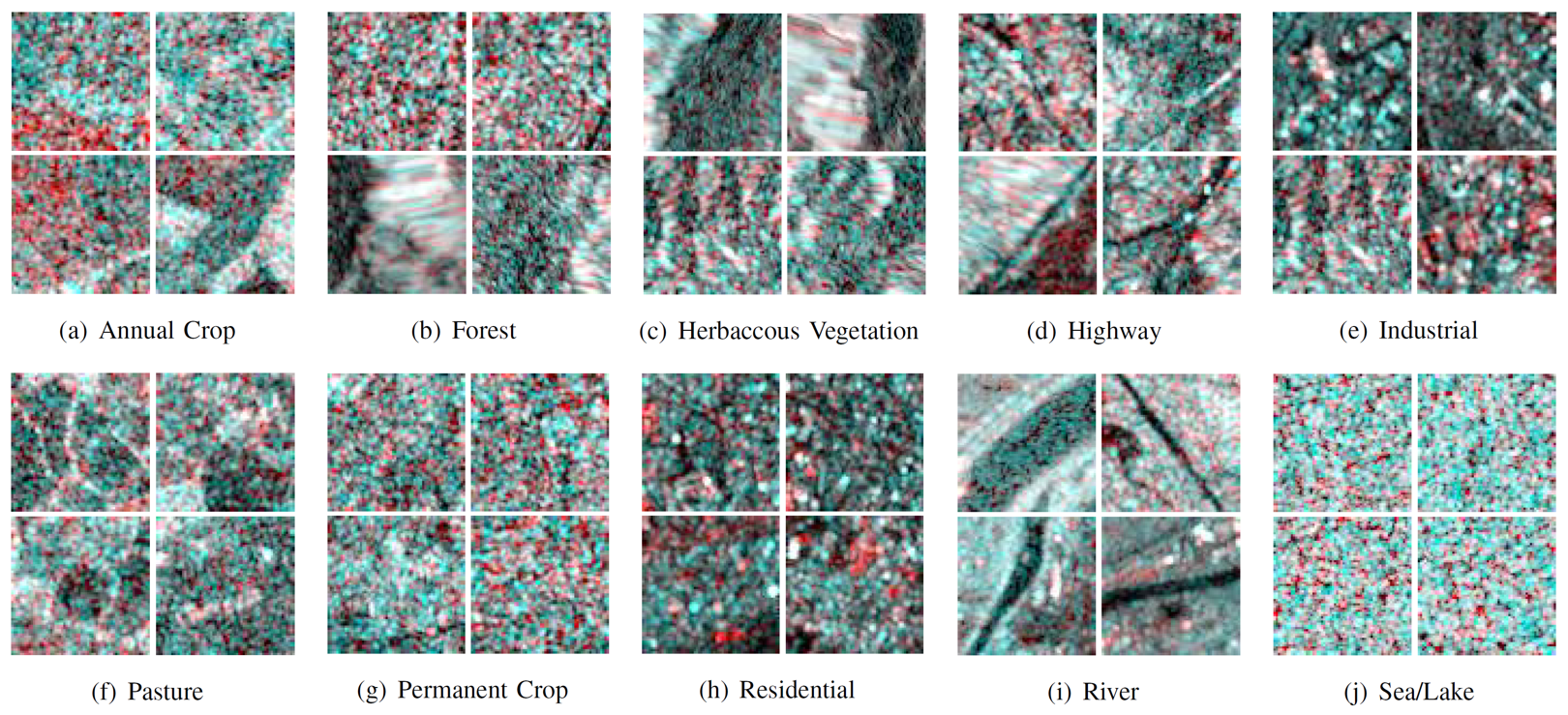
EuroSAT-SAR: Land Use and Land Cover Classification with Sentinel-1
The EuroSAT-SAR dataset is a SAR version of the popular EuroSAT dataset. We matched each Sentinel-2 image in EuroSAT with one Sentinel-1 patch according to the geospatial coordinates, ending up with 27,000 dual-pol Sentinel-1 SAR images divided in 10 classes. The EuroSAT-SAR dataset was collected as one downstream task in the work FG-MAE to serve as a CIFAR-like, clean, balanced ML-ready dataset for remote sensing SAR image recognition.
The dataset can be downloaded as a compressed zip file here.
Citation
@article{wang2023feature,
  title={Feature Guided Masked Autoencoder for Self-supervised Learning in Remote Sensing},
  author={Wang, Yi and Hern{\'a}ndez, Hugo Hern{\'a}ndez and Albrecht, Conrad M and Zhu, Xiao Xiang},
  journal={arXiv preprint arXiv:2310.18653},
  year={2023}
}