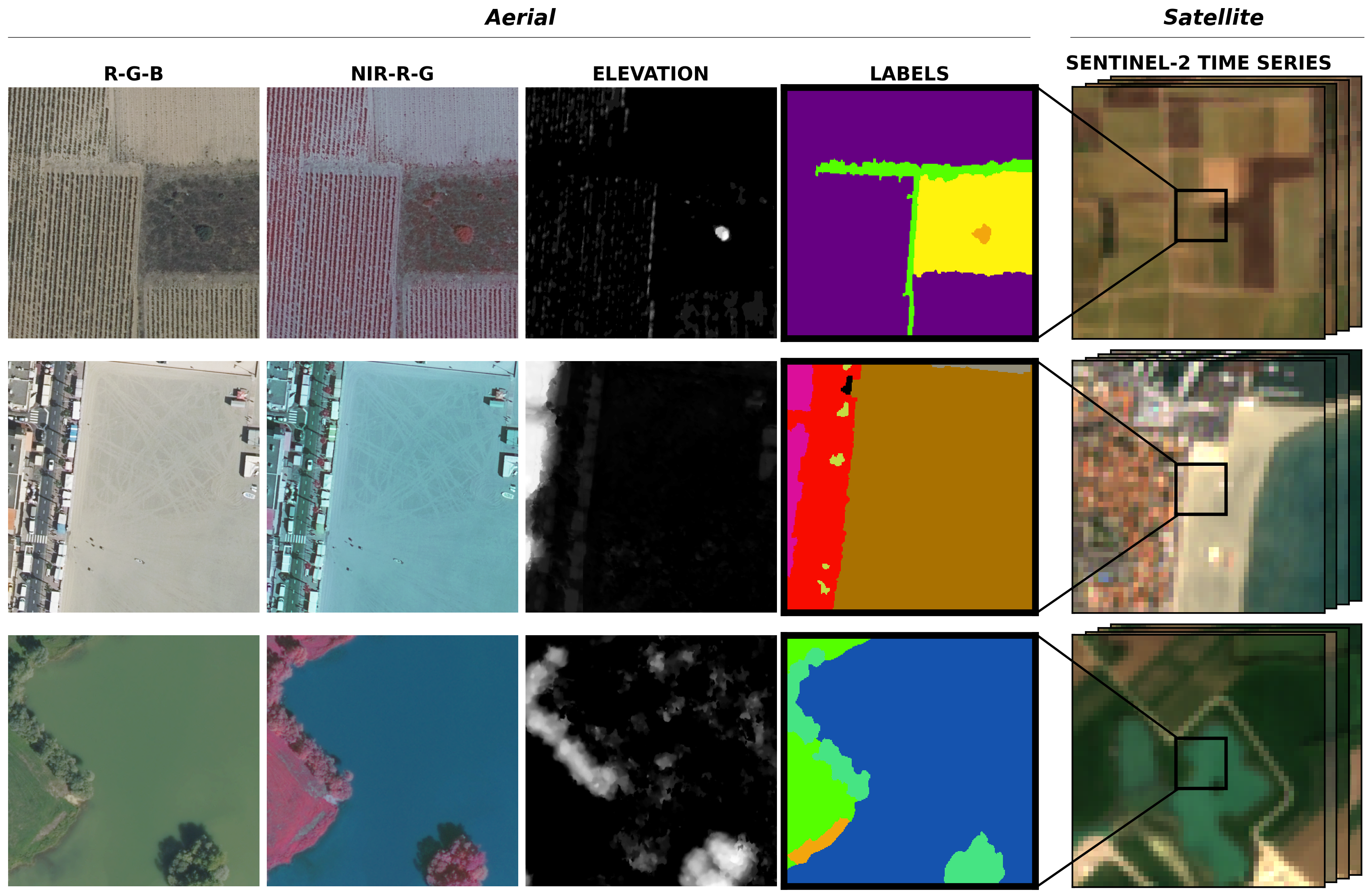
| Class | Train/val (%) | Test flair#1 (%) | Test flair#2 (%) | Class | Train/val (%) | Test flair#1 (%) | Test flair#2 (%) | ||
|---|---|---|---|---|---|---|---|---|---|
| (1) Building | 8.14 | 8.6 | 3.26 | (11) Agricultural Land | 10.98 | 6.95 | 18.19 | ||
| (2) Pervious surface | 8.25 | 7.34 | 3.82 | (12) Plowed land | 3.88 | 2.25 | 1.81 | ||
| (3) Impervious surface | 13.72 | 14.98 | 5.87 | (13) Swimming pool | 0.01 | 0.04 | 0.02 | ||
| (4) Bare soil | 3.47 | 4.36 | 1.6 | (14) Snow | 0.15 | - | - | ||
| (5) Water | 4.88 | 5.98 | 3.17 | (15) Clear cut | 0.15 | 0.01 | 0.82 | ||
| (6) Coniferous | 2.74 | 2.39 | 10.24 | (16) Mixed | 0.05 | - | 0.12 | ||
| (7) Deciduous | 15.38 | 13.91 | 24.79 | (17) Ligneous | 0.01 | 0.03 | - | ||
| (8) Brushwood | 6.95 | 6.91 | 3.81 | (18) Greenhouse | 0.12 | 0.2 | 0.15 | ||
| (9) Vineyard | 3.13 | 3.87 | 2.55 | (19) Other | 0.14 | 0.- | 0.04 | ||
| (10) Herbaceous vegetation | 17.84 | 22.17 | 19.76 |
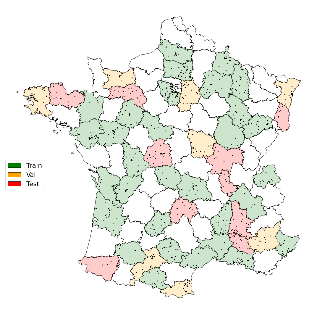
| TRAIN: | D006, D007, D008, D009, D013, D016, D017, D021, D023, D030, D032, D033, D034, D035, D038, D041, D044, D046, D049, D051, D052, D055, D060, D063, D070, D072, D074, D078, D080, D081, D086, D091 |
|---|---|
| VALIDATION: | D004, D014, D029, D031, D058, D066, D067, D077 |
| TEST-flair#1: | D012, D022, D026, D064, D068, D071, D075, D076, D083, D085 |
| TEST-flair#2: | D015, D022, D026, D036, D061, D064, D068, D069, D071, D084 |